


The Kanto region around Tokyo is one of Japan’s most rewarding hiking areas, with everything from cable-car temple hills to remote marshland plateaus. For visitors, the challenge is not finding trails but choosing the right one for your time, fitness and appetite for adventure. This guide compares some of the best-known hikes within reach of Tokyo, clearly separating easy sightseeing walks from serious mountain routes so you do not end up on an all-day climb when you only meant to stretch your legs between trains.
How to Choose the Right Kanto Hike for You
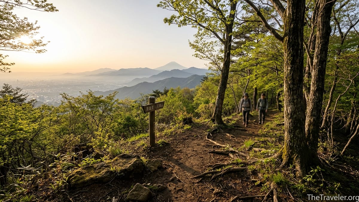
Tokyo day hikers are spoiled for choice. Within roughly two hours by train you can reach forested shrine mountains in Chichibu, ropeway-assisted ridges in Ibaraki and Chiba, volcanic rims in Hakone and wide-open marshland in Nikko and Oze. What varies most is not the scenery but the commitment. Some routes, like Mount Takao’s Trail 1, are closer to a paved pilgrimage than a hike, while others such as Oze’s long boardwalk loops or Gunma’s alpine routes around Mount Tanigawa demand planning, gear and an early start.
When deciding, think in terms of distance, elevation gain and logistics. As a rough guide, casual sightseeing walks in Kanto tend to be under 8 kilometers round trip with less than 400 meters of climbing, straightforward paths and frequent transport back to the city. Serious mountain hikes often exceed 10 kilometers, climb 600 meters or more, and may offer only a few buses per day at the trailhead. Season and weather matter too: low mountains around Tokyo are pleasant even in winter on dry days, while higher routes in Nikko, Oze and Gunma can hold snow well into late spring.
This article starts with easy-access peaks such as Mount Takao and Mount Mitake, then moves outward to Chichibu, Mount Tsukuba, Mount Nokogiri, Hakone, Nikko and Oze. For each area you will find typical distances, elevation and difficulty, the best seasons, and how to reach the trailhead by public transport. Cable cars, ropeways and rope-assisted stairways are noted where available, along with where you may need hiking shoes, trekking poles or overnight accommodation.
Mount Takao and Mount Mitake: Tokyo’s Classic Easy Escapes
Mount Takao is often the first “mountain” many Tokyo residents ever climb. At 599 meters, it is modest in height but very accessible, with frequent trains from Shinjuku to Takaosanguchi Station taking about 50 to 60 minutes. From there, the main Trail 1 route is roughly 6 kilometers round trip with about 400 meters of elevation gain if you walk the whole way. A cable car and chairlift can take you halfway up, cutting the climb significantly and leaving an easy paved walk of around an hour to the summit on a clear, well-signed path. This makes Takao ideal for casual hikers, families with children and visitors who want nature without committing to a full day in the mountains.
Takao’s difficulty depends on your route. Trail 1 is mostly paved and can feel crowded on weekends, especially during autumn foliage in November and on clear spring days. Side routes like Trail 6 or the Inariyama Ridge are more like proper hikes, with dirt paths, roots and steeper sections, but are still achievable for anyone of average fitness with sturdy sneakers. The mountain is open year-round, though summer can be hot and humid, and winter mornings can be icy in shaded areas. Facilities at the base and mid-station include restaurants, snack stalls and even a hot spring facility near the station, so no special preparation is required beyond a light jacket and water.
Mount Mitake, in the Okutama area of western Tokyo, offers a slightly wilder feel while remaining accessible. Trains run from central Tokyo to Mitake Station, then a short bus ride brings you to the base of the Mitake Tozan cable car. The funicular climbs roughly 400 meters in about six minutes to Mitakesan Station, where a village and the historic Musashi-Mitake Shrine sit on the ridge. A standard sightseeing circuit from the cable car station to the shrine and on to the Rock Garden ravine is around 5 to 7 kilometers with moderate ups and downs, suitable for reasonably fit walkers. Paths are mostly dirt and stone, and can be slippery after rain, so trainers with decent grip or light hiking shoes are recommended.
Mitake is best from April to early December, with spring greenery and autumn colors as highlights. In winter, higher sections can see ice and occasional snow, and many people carry simple traction devices on busy weekends. For visitors weighing Takao versus Mitake, the key difference is atmosphere: Takao is the quicker, more urban escape with heavy crowds; Mitake feels more like a mountain hamlet, with rustic lodgings and quieter forest trails beyond the main shrine. Both are casual hikes when you rely on the cable car, but extending from Mitake to neighboring peaks like Mount Hinode will tip your day toward a more serious mountain outing.
Chichibu and Sacred Forest Trails
Northwest of Tokyo, the Chichibu region in Saitama Prefecture is known for its forested mountains, pilgrimage routes and atmospheric shrines. Train lines such as the Seibu Chichibu Line and Chichibu Railway connect the area to the city in about 90 to 100 minutes, making it viable as a long day trip or an overnight stay. Unlike Takao, Chichibu’s trails quickly feel more rural, with fewer paved sections and fewer food stalls between trailheads and summits. The focus here is on quiet forest walks, temple visits and ridge traverses.
One popular area is around Mitsumine Shrine, a mountaintop complex accessible by bus from Seibu-Chichibu Station. Visitors can simply ride the bus up, walk the shrine precincts and enjoy short lookout paths, which makes this a casual sightseeing stop. However, there are also proper hiking routes that climb from the valley to the shrine or continue along ridges to neighboring peaks. These hikes often involve 700 to 1,000 meters of elevation gain over 8 to 12 kilometers and should be treated as full mountain days, particularly in summer heat or winter snow. Good boots, layered clothing and a headlamp are advisable if you venture beyond the shrines.
Another way to experience Chichibu is to walk sections of the Chichibu 34 Kannon pilgrimage. Some stretches link rural temples via forest paths and minor roads, with distances of 5 to 12 kilometers and gentle to moderate elevation changes. The difficulty is more about navigation and time management than steep climbing. These routes are ideal in spring and autumn when fields, riverbanks and hillsides are colorful but temperatures are mild. In winter, lower-elevation routes remain hikable on clear days, but starting early is important because buses between small villages may run only a few times a day.
Overall, Chichibu sits between casual and committed hiking. If you limit yourself to shrines and short connecting paths, you can manage comfortably in sneakers and a light backpack. If you aim for the full valley-to-ridge ascents or long pilgrim linkups, treat them like true mountain routes and bring solid footwear, rain gear and a printed map or offline map app. For many hikers who started with Takao or Mitake, Chichibu is a natural next step into more “real” terrain while still within reach of a late train back to Tokyo.
Mount Tsukuba and Mount Nokogiri: Contrasting Ropeway Peaks
On the eastern side of the Kanto Plain, Mount Tsukuba in Ibaraki and Mount Nokogiri in Chiba offer very different landscapes from the wooded hills west of Tokyo, yet are similarly accessible by public transport. Mount Tsukuba stands at just under 900 meters and is famous for its twin peaks, Nyotai-san and Nantai-san. Most visitors take a bus from Tsukuba Station to the base area, where both a cable car and a ropeway provide shortcuts up the mountain. A typical loop might involve taking the cable car up, walking along the rocky ridge between the two summits, then descending by foot, for a total of around 5 to 7 kilometers and roughly 400 to 500 meters of descent. The paths include stone steps, bouldery sections and narrow ridges, so even with ropeway assistance it feels more like a genuine hike than a promenade.
Tsukuba is popular year-round, with plum blossoms in late winter and early spring, lush greenery in early summer and fine foliage in November. On clear days, views stretch across the Kanto Plain toward Tokyo and sometimes Mount Fuji. Casual walkers can treat Tsukuba as a ropeway-supported outing, but anyone planning to descend on foot should wear sturdy shoes and be prepared for slippery rocks, especially in humid or rainy weather. Families with children often opt to ride both ways and limit walking to the short paths linking viewpoint platforms.
Mount Nokogiri on the Boso Peninsula in Chiba is much lower, at about 330 meters, but its dramatic cliffs, huge stone Buddhas and quarry-scarred rock faces give it a unique character. The Nokogiriyama Ropeway rises from near Tokyo Bay up to the ridge, from which a network of stone stairways and forested paths leads to viewpoints such as the knife-edge “Jigoku Nozoki” bluff and a giant carved Buddha. Distances here are relatively short; a circuit from the upper ropeway station through the main sights and back might total 4 to 6 kilometers, but the constant stair climbing can feel strenuous. Elevation gain is modest, around 250 to 350 meters depending on your route.
Because the terrain is heavily stair-based and well defined, Nokogiri is very much a sightseeing hike. It suits visitors who prefer clear paths and concrete steps over muddy trails, and you can comfortably visit in sneakers if conditions are dry. That said, the cliff edges and stone stairs can be slippery, so caution is required, especially with children. The area can be hot and exposed in summer, so carrying water and a hat is essential. For Tokyo-based travelers, Nokogiri is best treated as a relaxed day combining a bay crossing, ropeway ride and a half-day of walking rather than a demanding mountain objective.
Hakone: Volcanic Rims and Historic Roads
Hakone, southwest of Tokyo in Kanagawa Prefecture, is usually known for hot springs and lake views, but it also offers varied hiking. The area is part of the Fuji-Hakone-Izu National Park and is built around an ancient volcanic caldera. Trails range from the gentle stone-paved Old Tokaido Road between Hakone-Yumoto and Lake Ashi to more demanding ridge routes such as Mount Kintoki or the outer rim traverse. Access is straightforward: many hikers travel by Odakyu Line train or romancecar to Hakone-Yumoto, then use buses, the Hakone Tozan Railway or ropeways to reach trailheads.
The Old Tokaido section often walked by visitors runs roughly 7 to 8 kilometers between Hakone-Yumoto or Moto-Hakone and Lake Ashi, with several entry and exit points along the way. Elevation gain is moderate, around 300 to 400 meters, and the path includes preserved stone paving, tall cedars and old checkpoint sites. This is firmly in the casual sightseeing category. You can walk in regular shoes on dry days, though the stones can be slippery when wet. The route is attractive in all seasons except days of heavy snow or prolonged rain, and it fits well into a day that also includes a lake cruise or onsen visit.
In contrast, Hakone’s mountain routes such as Mount Kintoki or the rim trails demand more effort. A typical ascent of Mount Kintoki involves around 600 to 700 meters of elevation gain over 6 to 8 kilometers, depending on the starting point. Paths are dirt and rock, often steep, and views of Mount Fuji from the summit are a major draw in winter and clear spring days. Another option is the route between Mount Myojo and Mount Kintoki, part of the old caldera rim, which can extend a day to 10 kilometers or more. These hikes are best considered serious mountain outings despite their proximity to resort hotels and cafes.
Seasons influence the character of Hakone hikes. Summer brings lush greenery but also humidity and afternoon storms. Autumn offers clear air and foliage but also crowded trains and buses. Winter can be excellent for Mount Fuji views yet icy on shaded slopes. Anyone tackling the mountain routes should bring hiking boots, warm layers, gloves in cooler seasons and perhaps trekking poles for steep descents. In contrast, Old Tokaido walkers can travel light, focusing on water, a rain jacket and enough time to catch their bus or train back.
Nikko and Senjogahara: High Marshland Walks
Nikko, in Tochigi Prefecture, is famous for its ornate shrines and autumn colors, but the surrounding national park contains some of Kanto’s most beautiful highland walking. Trains from Tokyo or Asakusa connect to Nikko in around two hours, followed by buses up to the Okunikko area near Lake Chuzenji and beyond. Once you reach the plateau, you are already at around 1,200 to 1,400 meters of elevation, which shapes the climate and the type of trails you will find.
The Senjogahara Marshland is a classic example of a casual but rewarding highland hike. Boardwalks and well-maintained dirt paths form a nature trail of roughly 5 to 7 kilometers, typically taking two to three hours at a leisurely pace. Elevation change is modest, often under 150 meters, and the route passes through open marshland, riverbanks and light forest with views of surrounding peaks such as Mount Nantai. Because the path is mostly flat and clearly marked, it is suitable for visitors in sturdy walking shoes, and there are several bus stops at different entry and exit points, allowing flexible itineraries.
Senjogahara is especially attractive from late May through October, when the marsh grasses and wildflowers are at their best, and in October when the larch forests turn golden. In early spring and late autumn, snow patches and frozen boardwalks are possible, and winter brings full snow cover that is better suited to experienced hikers with winter gear. Nearby, Lake Chuzenji and other Okunikko trails offer additional half-day walks with similar profiles: moderate distances, gentle ups and downs and strong scenery. These are still hikes rather than city strolls, so a small daypack with water, snacks, rainwear and a warmer layer is advisable.
While the shrine area in lower Nikko can be enjoyed in street shoes and without much planning, the Okunikko and Senjogahara trails sit in the middle ground. They are not strenuous mountain climbs, but altitude and weather can change quickly. Visitors should leave extra time for potentially infrequent return buses and pay attention to seasonal notices at visitor centers, especially regarding bear activity, temporary trail closures or boardwalk repairs.
Oze and Gunma’s Higher Mountain Routes
For hikers ready to move beyond day trips from Tokyo into more committed mountain territory, Oze National Park and selected mountains in neighboring Gunma Prefecture are natural next steps. Reaching Oze from Tokyo typically involves train travel to Gunma or Fukushima followed by a bus to trailheads such as Hatomachi-toge. Total travel time often exceeds three hours one way, and many visitors stay overnight in mountain lodges or at simple accommodations in gateway towns. Once there, however, the reward is a wide basin of marshlands, rivers and surrounding peaks that feel far removed from city life.
The classic Oze route is a boardwalk loop across Oze Marsh, often starting and finishing at Hatomachi-toge. A common circuit might be around 8 to 10 kilometers with relatively small elevation changes on the marsh itself, though accessing the area from the pass involves a descent and re-ascent of several hundred meters. Many people spend one night at a lodge near the marsh and extend their walks to nearby peaks such as Mount Hiuchigatake or Mount Shibutsu, which add 600 to 800 meters of climbing and move firmly into serious mountain territory. Even the “easy” marsh loops are long and exposed, so weatherproof clothing, good footwear and a sense of timing are essential.
Seasonality is critical in Oze. The main hiking season usually runs from late May to October, with lingering snow early in the season and brilliant autumn colors followed by closure as winter approaches. Outside this window, snow and ice make access and walking the boardwalks hazardous without specialized gear and experience. Facilities such as lodges, toilets and bus services also operate on seasonal schedules, so hikers must check current information before traveling. Prices for lodge stays are often on a half-board system, with dinner and breakfast included, and reservations are typically required.
Elsewhere in Gunma, mountains along the prefectural borders such as Mount Tanigawa offer challenging routes with dramatic ridges, cable cars and serious weather exposure. A basic out-and-back from the top of the Tanigawadake ropeway to the summit can involve around 500 to 600 meters of climbing over rocky, sometimes chain-assisted paths. Distances range from 5 to 10 kilometers depending on the route, and fog, high winds and sudden storms are not uncommon, even in midsummer. These are not hikes to attempt in casual shoes or on a whim at midday after leaving Tokyo.
Because of their altitude, distance from the city and potential hazards, Oze and higher Gunma peaks should be considered full-scale mountain objectives. Proper hiking boots, rainwear, extra warm layers, gloves, a headlamp, map, sufficient food and a clear turnaround time are basic requirements. They are excellent options for hikers who have already tested themselves on places like Mitake, Chichibu and Hakone and now want bigger views and quieter trails, but they are not suitable as introductory outings for first-time visitors who simply want a taste of nature near Tokyo.
The Takeaway
Seen from Tokyo’s train lines, the Kanto region might appear as a flat urban plain, yet within a few hours lie shrine-topped hills, volcanic rims, high marshes and deep forest valleys. Choosing the right hike here is less about finding a famous name and more about matching your expectations and experience level to what awaits on the ground. Mount Takao, Mount Mitake, Mount Nokogiri and much of Hakone’s Old Tokaido offer accessible, cable-car-assisted days that blend culture and scenery with relatively modest exertion. They are ideal for jet-lagged travelers, families and anyone who prefers to hike in regular walking shoes.
By contrast, longer routes in Chichibu, Hakone’s peaks, the marsh and ridge networks of Nikko and the expansive boardwalk and summit options in Oze and Gunma move into serious hiking territory. Distances stretch, elevation gains increase, and weather, bus schedules and personal fitness all begin to matter more. Treating these as true mountain routes means packing appropriate gear, watching the clock and having backup plans for accommodation and transport. With realistic expectations and a bit of preparation, however, Kanto becomes less a vague “area around Tokyo” and more a richly varied hiking region in its own right, capable of rewarding both first-time visitors and seasoned hikers over many days and many trips.
FAQ
Q1. Is Mount Takao suitable for complete beginners?
Yes. If you use the cable car or chairlift, follow Trail 1 and wear comfortable walking shoes, Mount Takao is very manageable for beginners and families.
Q2. How do Mount Takao and Mount Mitake compare for a day trip from Tokyo?
Takao is slightly closer and more developed, with more food options and paved paths. Mitake feels more like a mountain village with quieter forest trails beyond the shrine.
Q3. Do I need hiking boots for Chichibu’s shrine and pilgrimage routes?
For short shrine visits and gentle sections, sturdy sneakers are usually fine. For longer valley-to-ridge hikes, proper hiking boots are strongly recommended.
Q4. Can I hike Mount Tsukuba with children?
Many families ride the cable car or ropeway up, walk short sections on the ridge and return by lift. Full ascents and rocky descents are better for older, active children.
Q5. Is Mount Nokogiri dangerous because of its cliffs?
There are dramatic drop-offs, but main viewing areas are fenced and paths are clear. The main risks are slippery stone steps and crowded viewpoints, so move carefully.
Q6. What is the easiest hike in Hakone for first-time visitors?
The Old Tokaido Road section near Lake Ashi is a good choice. It offers historic stone paving, cedar forests and moderate elevation, suitable for people in walking shoes.
Q7. When is the best season to hike the Senjogahara trail in Nikko?
Late May to October is ideal, with lush marshland in summer and golden larch forests in autumn. Outside this window, expect snow and potentially icy boardwalks.
Q8. Is Oze National Park possible as a day trip from Tokyo?
It is technically possible but rushed. Because of long travel times and extensive trails, most hikers stay at least one night in or near Oze.
Q9. Are there cable-car options for serious mountain hikes in Gunma?
Yes. For example, the Tanigawadake ropeway shortens the approach, but the remaining summit trails are still steep, rocky and require full mountain gear and care.
Q10. How should I prepare if I am unsure whether a route is casual or serious?
If in doubt, plan conservatively: choose a shorter route, start early, wear proper shoes, carry rain gear and enough food, and check local tourist information for recent advice.