


Shikoku rewards travelers who are willing to get behind the wheel. Trains and buses hug the coasts and larger cities, but the island’s soul lies inland on single lane mountain roads, quiet pilgrimage temples and riverside towns that feel a world away from bullet train Japan. A car turns Shikoku from a linear rail trip into a true loop, linking Matsuyama, Ozu, Kochi, the Shimanto River, Cape Ashizuri, the Iya Valley, Kotohira, Takamatsu and Tokushima in one sweeping circuit.
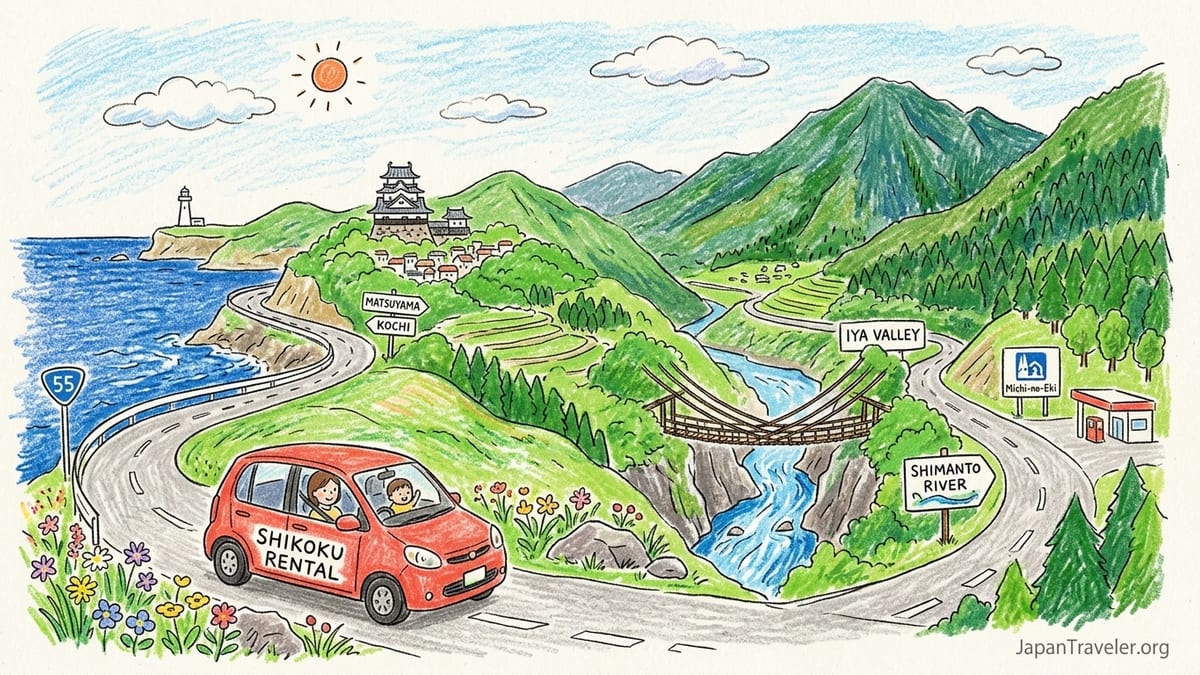
Why Shikoku Is Made for a Car First Adventure
On paper, Shikoku looks connected. The Matsuyama Expressway, Kochi Expressway and Tokushima and Takamatsu Expressways form a rough ring, with National Routes such as 11 and 55 tying together the main cities. In reality, public transport thins out quickly once you leave the coastal corridors. Buses into the Iya Valley run only a few times a day, local trains along the Shimanto River crawl through the hills and getting from one valley to the next without your own wheels can mean long waits at rural stations. A car changes the equation, turning those awkward gaps into the best parts of the journey.
With a rental car you can leave Matsuyama after breakfast, detour through the preserved streets of Uchiko, loop down to Ozu for riverside castle views, then still roll into Kochi in time for dinner at Hirome Market. The same distance by rail often involves backtracking via Utazu near Takamatsu and multiple transfers that eat up the day. A drive between Kochi and Matsuyama that can take just over two hours by expressway can easily stretch much longer by train, which is why many recent visitors report choosing the car even when they are usually rail devoted travelers.
Driving also lets you treat Shikoku’s cities as hubs rather than final destinations. Matsuyama becomes a base to slip down to Ozu or out to rural Ehime, Kochi is a launch point for day drives to Katsurahama or the Shimanto watershed, and Takamatsu opens the Sanuki plain and Konpira Shrine in Kotohira without juggling train timetables. On a seven day loop you are rarely driving more than three hours in a single stretch, yet you reach places that would require an overnight stop if you were relying solely on trains and buses.
Recent road trip reports from 2025 and 2026 highlight how modern navigation and widespread expressways make self drive travel on Shikoku far more approachable than many first time visitors expect. Rental agencies at Matsuyama, Kochi and Takamatsu airports commonly include ETC toll cards and English navigation systems, and prefectural tourism offices publish English language drive maps that show scenic routes, roadside stations and rest areas. Combined with generally courteous local driving, this makes Shikoku one of the most satisfying regions in Japan to explore by car.
Planning a Seven Day Loop: Matsuyama to Tokushima
A practical seven day loop starts and ends in Matsuyama, using the city’s airport or ferry terminal, and runs clockwise through Ozu, Kochi, Shimanto, Cape Ashizuri, the Iya Valley, Kotohira, Takamatsu and Tokushima before closing the circle. Distances between the major city pairs, such as roughly 155 kilometers between Matsuyama and Kochi or around 160 kilometers between Matsuyama and Takamatsu, are short enough to keep daily drives flexible while leaving room for detours along the way.
One workable pattern is to collect your car at Matsuyama Airport around midday and head directly to Ozu, barely an hour away on the Matsuyama Expressway and National Route 56. After a night in castle town accommodation, continue to Kochi on a mix of expressway and coastal roads, arriving in time to return the car at a downtown branch if you prefer to explore Kochi city center on foot. From Kochi, pick up another car the next morning for the remote sectors: down the Shimanto River and out to Cape Ashizuri on quiet National Routes before circling back inland toward the Iya Valley.
From western Kochi Prefecture you can climb slowly into Tokushima’s interior. Many drivers follow the Shimanto upstream, cross over toward the Oboke and Koboke gorges on the Yoshino River and then snake into the Iya Valley. The drive itself is the attraction here, as you pass farmhouses clinging to slopes and vine bridge turnoffs that are almost unreachable by public transport. After at least one night in Iya, continue to Kotohira on National Route 32, using this small hot spring town as a gentle reentry to flatter roads, before finishing with a night or two in Takamatsu and an onward hop to Tokushima to close the loop.
This itinerary keeps your longest days to roughly three hours of net driving, with plenty of shorter hops between sights. It also uses cities like Matsuyama, Kochi and Takamatsu as logical points to pick up or drop off vehicles, letting you return the car before plunging into dense downtown grids where paid parking and one way streets are more common.
Expressways, Tolls and Everyday Driving Costs
Shikoku’s expressway network is what makes this loop practical in a week without feeling rushed. The Matsuyama Expressway runs along much of Ehime’s spine, linking Matsuyama with Ozu and beyond, while the Kochi Expressway and Tokushima Expressway connect Kochi and Tokushima through the interior. The Takamatsu Expressway ties Kagawa’s north coast into this system. Together they give you an efficient skeleton, with national routes and minor roads branching off to more scenic areas.
Most overseas drivers rent cars that include an ETC card reader for touch free toll payment. At a typical rate pattern in 2026, a two to three hour expressway hop between major cities often costs the equivalent of 2,000 to 4,000 yen for a standard sized car if paid at the standard rate, with discounted ETC fares sometimes lower. For example, a sample toll calculation between Donari on the Tokushima Expressway and Takamatsu East on the Takamatsu Expressway, a drive of around 145 kilometers, comes out just under 4,000 yen at the regular rate for a mid sized car. Over a full week circling Shikoku, many couples report toll budgets in the range of 10,000 to 20,000 yen, depending on how often they leave and rejoin the expressways.
A realistic fuel budget is modest by comparison. In 2025 and 2026 typical rental fleets in Shikoku include compact Toyota and Nissan sedans and small hybrid wagons that average around 15 to 20 kilometers per liter. Given that a circuit dropping down to Shimanto and the Iya Valley might total 800 to 1,000 kilometers, you can expect to fill up two or three times, spending somewhere around 8,000 to 15,000 yen in total, depending on fuel prices at the time and your exact route. Roadside stations and highway service areas almost always have fuel within a short detour, and recent drivers highlight that even in mountainous areas, petrol stations tend to appear before you reach anxiety inducing levels.
If you are watching costs, you can keep your ETC card for longer intercity stints but drop down to national routes such as Route 11 between Tokushima and Matsuyama or Route 55 between Tokushima and Kochi, especially when you are not in a hurry. These roads are toll free and frequently scenic, often following coastlines or rivers, though they can pass through long stretches of traffic lights and roadside suburbs. Many travelers find a balance by taking the expressway early to leap out of city sprawl, then shifting to slower routes once the scenery improves.
Mountain Roads, Iya Valley and Shimanto: What to Expect Behind the Wheel
The stretch that intimidates first time visitors most is the drive into the Iya Valley and along minor roads near the Shimanto River. Online tales of “white knuckle” lanes hide a more nuanced reality. The main access roads into Iya from the Oboke area are paved two lane roads with guardrails, tunnels and regular pull outs. You will encounter narrow segments and tight hairpins, but they are manageable for drivers who are comfortable with rural driving and stay within the speed limit. It is when you branch off toward remote hamlets, historic vine bridges or Oku Iya viewpoints that single lane roads, cliff edge drops and blind corners become more common.
Recent road trippers describe stretches where they needed to reverse into a passing bay to let an oncoming van squeeze by, or where stone walls and drainage gullies left only a hand’s width on either side of the car. They also report that local drivers are patient and that traffic is light enough that such encounters are more occasional stress spikes than constant pressure. The key is to rent a smaller car rather than an SUV. A compact sedan or hatchback with good visibility and a modest width makes local streets, minshuku parking areas and multi story garages in cities far less nerve wracking.
The Shimanto area is less dramatically narrow but still rewards caution. National Route 381 and local riverside roads often run right along the water, with no shoulder between you and low guardrails. In exchange you get the classic Shikoku driving image: low concrete submersible bridges, tea fields on the slopes and canoes gliding on deep blue water. Detours to villages like Ekawasaki or riverside cafes may lead you down smaller spurs where it pays to slow to walking pace around blind bends. Travelers who drove this region during typhoons note that heavy rain can transform gentle streams into torrent filled canyons, so it is wise to watch local advisories in typhoon season and keep your plans flexible.
Cape Ashizuri lies at the end of a peninsula, reached by a ribbon of road that swings through fishing ports and forested headlands. The final approach is mostly two lane but can feel tight where vegetation crowds the roadside. Arriving by mid afternoon lets you park at the main lot and walk to the lighthouse and cliff top trails before returning to a coastal town such as Nakamura or Sukumo for the night. Without a car, visiting Cape Ashizuri from the Shimanto River area usually involves awkward bus changes and limited departure times, which is precisely why self drive travel shines here.
Parking, City Traffic and When to Return the Car
Shikoku’s medium sized cities are generally easier to drive in than Osaka or Fukuoka, but they still have one way grids, height restricted parking and tram lines that complicate navigation. A practical rule is to keep the car when it enhances flexibility and daylight sightseeing, then return it before you settle into dense downtown areas where you plan to spend most of your time on foot. Matsuyama, Kochi and Takamatsu are prime examples where this strategy works well.
In Matsuyama, many hotels near the tram lines partner with mechanical car stackers that have height limits. Travelers who arrived in tall minicars or compact vans report being turned away from these garages and directed to more expensive open air lots a few blocks away. Booking accommodation that confirms on site parking for regular height vehicles avoids last minute surprises. If you plan to spend a full day visiting Matsuyama Castle, Dogo Onsen and the city’s museums, consider timing your rental so you pick up the car only as you leave town, collecting it in the late afternoon before heading toward Ozu.
Kochi presents a similar tradeoff. The city center around Hirome Market and Kochi Castle is walkable and filled with small pay lots that charge by the hour. If your sightseeing is focused purely inside the city, it can be cheaper and less stressful to drop the car at Kochi Station or Kochi Airport when you arrive, then pick up a fresh rental the day you drive on toward Shimanto. On the other hand, if you want to visit Katsurahama Beach, the Sunday Market and outlying viewpoints in a single day, keeping the car for that extra night pays off in flexibility.
Takamatsu sits between these extremes. The harbor and castle park are close to each other, and street level coin parking lots are common and relatively affordable by Japanese city standards, often charging a capped day rate. However, multistory garages close to the station and business hotels can be tight for wide cars. Many recent drivers recommend leaving the car at your accommodation during the day and using local trains or on foot to reach Kotoden Takamatsu Chikko Station for ferries or shopping. If your loop ends in Tokushima, it can make sense to return the car in Takamatsu and complete the last leg by train or highway bus, especially if you feel you have had your fill of driving by then.
Rental Logistics, One Way Fees and Seasonal Conditions
Shikoku’s main airports and city stations host branches of national rental chains such as Toyota Rent a Car, Nippon Rent a Car and Times Car Rental. Matsuyama, Kochi and Takamatsu airports usually have counters that cater to international visitors with English materials and optional GPS units with English voice guidance. Booking in advance through the English sites of these companies or through major aggregators remains important in peak seasons such as Golden Week, August and the autumn foliage period in November, when compact cars can sell out.
One way rentals within Shikoku are widely supported. Companies publish matrices showing permitted combinations such as Matsuyama to Kochi, Kochi to Tokushima or Tokushima to Takamatsu, along with surcharges. As a rough guide, dropping a car in a different Shikoku prefecture can add the equivalent of 5,000 to 15,000 yen to your rental, depending on distance and company policy. Some travelers mitigate this by doing two or three shorter rentals that follow their loop, for instance Matsuyama to Kochi, Kochi to Takamatsu and a final day rental around Tokushima, which keeps each one way fee low and aligns neatly with city focused segments.
Winter driving on Shikoku is milder than in Tohoku or Hokkaido, but the island’s mountains still see snow and ice. The Iya Valley and passes around Shikoku Karst sit high enough that cold snaps can bring slippery conditions and occasional road closures. Expressway operators publish winter driving advice that emphasizes the need for winter tires or chains when regulations are in force, and digital signs at toll gates and service areas display restrictions such as winter tire requirements or closures. In most typical winters, major roads remain passable for the majority of days, but travelers visiting between December and early March should check conditions each morning and be prepared to adjust their plans, especially if their rental does not come with proper winter equipment.
Typhoon season from late summer into early autumn brings a different kind of challenge. Heavy rain can cause temporary closures of smaller roads and landslide risks in steep valleys. Drivers who encountered a typhoon in the Iya region recall slowing to a crawl in sheets of rain and waiting out the worst in roadside stations. A flexible itinerary that allows you to swap a mountain day for a museum day in Matsuyama or Kochi is your best insurance. Rental companies are generally understanding about delays due to official road closures, but they will expect the car to be returned as soon as it is safe and practical.
Temple Side Roads and Small Town Detours
Shikoku’s famous pilgrimage route, the 88 Temple circuit, was designed for walkers but many of its rural temples sit on hillsides or in folds of the landscape that trains and buses barely touch. Having a car lets you thread some of these into your road trip without devoting entire days to them. Near Tokushima, temples in the low mountains orbiting the city can be reached by short spurs off National Route 192 and the Tokushima Expressway exits. Around Kochi, rural temples north of the city involve drives through rice terraces and cedar forests that give a very different feel to urban temple visits.
The approach roads to these temples are often the narrowest you will encounter on the whole loop. Expect short, steep lanes with hairpin turns, mirrored corners and concrete gutters. Many temple car parks are simple gravel forecourts where volunteers direct cars into tight lines during busy periods. Arriving early in the morning or later in the afternoon avoids tour bus crowds and makes manoeuvring much easier, particularly if you are still building confidence with Japan’s left side driving.
Beyond temples, a car opens up small towns that are hard to justify on a rail based itinerary. Ozu in Ehime, with its riverside castle and restored merchant quarter, becomes a natural overnight stop between Matsuyama and Kochi when you are driving. In Kagawa, Kotohira transforms from a rushed half day excursion into a slow evening soak in onsen and a dawn climb of the Konpira Shrine steps without lugging luggage up from the station. In Kochi Prefecture, tiny settlements along the Shimanto and Yo River valleys offer minshuku stays where you park under persimmon trees and eat river fish caught that afternoon.
Because these detours are where you are most likely to get lost down lanes that barely look like roads, it is important to double check your navigation settings. Many recent visitors recommend using a combination of the in car GPS, Google Maps on an offline download and, when possible, map codes from local tourism brochures that pinpoint car parks rather than temple halls. If your GPS does direct you down a route that seems impossibly narrow, do not hesitate to pull into a lay by and re route. Locals are used to visitors being cautious and would rather see you backtrack than block a blind corner.
The Takeaway
A Shikoku road trip is not about racing between expressway exits. It is about having the freedom to leave the mainline whenever the scenery or a side road sign catches your eye, to stop at a rural bakery in Ehime or a vegetable market in Kochi and to reach vistas like Cape Ashizuri or side valleys in Iya that buses treat as afterthoughts. A seven day loop that threads Matsuyama, Ozu, Kochi, Shimanto, Cape Ashizuri, the Iya Valley, Kotohira, Takamatsu and Tokushima turns the island into a continuous story rather than a series of disconnected train segments.
Driving comes with responsibilities: keeping an eye on toll and fuel costs, respecting narrow lanes and local traffic, knowing when to swap the steering wheel for walking shoes in city centers and staying alert to winter and typhoon season conditions. Yet the rewards are disproportionate. You gain sunrise viewpoints, empty riverbanks, pilgrimage temples bathed in late afternoon light and the quiet satisfaction of cresting a pass to find another valley unfolding below. For travelers comfortable behind the wheel, Shikoku remains one of Japan’s most compelling self drive regions.
FAQ
Q1. Do I need an International Driving Permit to rent a car in Shikoku?
Most visitors who are not from countries with a reciprocal license agreement with Japan need an International Driving Permit based on the 1949 convention, plus their home license, to rent a car. It is essential to obtain this before arriving in Japan, as rental companies in Shikoku will not issue cars without the proper documents.
Q2. Is driving in the Iya Valley safe for someone with limited mountain driving experience?
The main roads into the Iya Valley are paved and generally well maintained, but they include narrow sections, tunnels and hairpin curves. Drivers who are comfortable on rural roads, keep their speed low and choose a compact car generally find it manageable. If you are very nervous, consider limiting yourself to the main valley road and avoiding the smallest side lanes on your first visit.
Q3. How expensive are tolls on a seven day Shikoku loop?
Toll costs depend on how often you use the expressways. Many travelers doing a full circuit that includes Matsuyama, Kochi, Shimanto, Iya, Kotohira, Takamatsu and Tokushima report spending roughly between 10,000 and 20,000 yen on tolls for a standard sized car when using expressways for the main intercity legs.
Q4. Can I rely on English navigation in a Shikoku rental car?
Most major rental companies at Matsuyama, Kochi and Takamatsu airports offer vehicles with navigation units that support English menus and voice guidance. However, interfaces can still feel dated, so many drivers supplement them with smartphone navigation apps and offline maps as a backup.
Q5. What is parking like in cities such as Matsuyama, Kochi and Takamatsu?
City centers offer a mix of hotel garages, mechanical stackers with height limits and open air coin parking. Parking fees are usually moderate by Japanese standards, with capped day rates in many lots. Booking hotels that clearly state parking availability and maximum vehicle size helps avoid surprises, particularly if you are driving a taller car.
Q6. Are one way rentals between Shikoku cities easy to arrange?
Yes, one way rentals are common between major cities such as Matsuyama, Kochi, Tokushima and Takamatsu. Rental companies typically charge a drop off fee that rises with distance, often adding the equivalent of 5,000 to 15,000 yen to the base rental cost for inter prefectural returns.
Q7. When is the best season to drive in Shikoku?
Spring and autumn are the most comfortable seasons, with mild temperatures and generally stable weather. Summer brings lush scenery but higher humidity and the risk of typhoons, while winter is quieter but can involve snow and ice on higher passes, especially around Iya and interior routes.
Q8. Should I avoid driving into busy city centers altogether?
You do not need to avoid city centers entirely, but it often makes sense to return the car when you plan to stay multiple nights in compact downtown areas. Exploring central Matsuyama, Kochi or Takamatsu on foot, by tram or by local train can be less stressful and may cost less than keeping a car parked for days.
Q9. How small should my rental car be for mountain and village roads?
A compact sedan or hatchback is ideal for most Shikoku roads. Kei cars and small hybrids are easier to maneuver and park than large sedans or SUVs, particularly on single lane mountain roads and in tight temple or minshuku car parks.
Q10. Are gas stations frequent enough in rural areas like Shimanto and Iya?
While gas stations are less frequent in rural areas than along the coasts, they are still available in most larger villages and at intervals along main valley roads. Keeping your tank above half full when heading into remote sections such as the upper Shimanto or Oku Iya gives you a comfortable safety margin.