


On a cool July morning in Wakkanai, standing at the northern tip of Hokkaido with a sea fog drifting over the harbor, I boarded the Heartland Ferry bound for Rebun and Rishiri. I had come for wildflowers and volcanic coastlines rather than beaches and palm trees, determined to give these northern islands the time they deserve instead of rushing them as a day trip. Over four days and three nights, with a pack full of rain gear, a camera, and far fewer clothes than you might pack for Okinawa, I found an Arctic-tinged side of Japan built for hikers who prefer edelweiss to hibiscus and wool hats to sun umbrellas.
Starting From Wakkanai: Ferries, Weather and Logistics
Everything about a trip to Rebun and Rishiri starts in Wakkanai, Japan’s northernmost city. The Heartland Ferry terminal sits a short taxi ride from Wakkanai Station, and on my departure day the lobby was a mix of backpackers, older Japanese hiking groups in matching gaiters, and locals loading cardboard boxes onto freight carts. For 2026, Heartland Ferry operates multiple daily sailings from Wakkanai to both Kafuka on Rebun and Oshidomari on Rishiri, with extra departures in summer. Between June and September there are typically morning and midday ferries in each direction, but services can be cancelled on short notice when the wind comes up, so I bought my ticket at the counter about an hour before departure and kept my schedule flexible.
For a solo traveler on foot, the standard passenger fare from Wakkanai to Rebun or Rishiri in 2026 is in the low 3,000 yen range one way in second class, depending on the route and season, with discounts for round trips and options to pay more for a reserved seat or Japanese style carpeted area. I opted for the basic second-class ticket to Kafuka on Rebun, about a two hour sailing, and reserved a separate ticket for Rishiri two days later to avoid tying my whole plan to a single round trip. Vehicles, including rental cars, can be taken on board, but the cost rises sharply for cars and is best checked in advance, especially in peak flower season.
Weather shapes everything in this corner of Hokkaido. Even in midsummer, daytime temperatures in Wakkanai and the islands often sit around 15 to 20 degrees Celsius, with sea fog, drizzle and brisk winds common. On my departure, it was about 16 degrees, windy enough that whitecaps flecked the harbor. I wore a light down jacket and kept my rain shell handy. On deck, the wind cut through fleece and jeans, and I was glad I had a warm hat instead of the straw sun hat that appears in so many southern-island brochures. Luggage storage on the ferry is straightforward: larger backpacks and suitcases are left in a designated open rack area near the vehicle deck, while smaller daypacks can be carried into the passenger lounges. I kept my camera, valuables and a dry layer with me and left the rest downstairs.
Because I knew I wanted unrushed hiking days, I booked all accommodations before leaving the mainland. My first two nights were on Rebun, in a small minshuku a bus ride from Kafuka, and my third night on Rishiri close to Himenuma Pond. Both places requested an estimated arrival time, and I built my ferry choices backward from those times, allowing for at least one later ferry as a backup if the morning sailing was cancelled. In this part of Japan, the biggest logistical mistake is underestimating how regularly the wind can shut down ferries, so I planned at least one extra day in my wider Hokkaido schedule in case I needed to wait in Wakkanai.
First Impressions of Rebun: Island of Flowers and Sea Cliffs
Rebun is often called Japan’s “Floating Island of Flowers,” and stepping off the ferry in Kafuka in early July, the name felt accurate. Cool air carried the scent of wet grass and seaweed. The hills behind the port were not dramatic peaks but rounded green ridges sweeping down to the water. A few old buses waited outside the terminal, along with a handful of taxis, cyclists packing panniers, and hikers comparing map printouts of the island’s trail network.
The island runs roughly north to south, with a web of trekking routes that range from quick coastal walks to the full day “Eight Hour Course” that crosses almost the entire length. I wanted a concentrated but not punishing introduction, so I chose the Momoiwa Observatory Course on the southern part of the island, a route promoted by local tourism offices as one of the best flower and coastline combinations. Official trail maps describe it as around 6 to 7 kilometers between trailheads, with about 250 meters of elevation gain and generally moderate difficulty for anyone comfortable with uneven ground.
From Kafuka, a short local bus ride brought me near the trailhead. During the main summer months, buses link the ferry terminal with key trail access points, but services are infrequent, often only a handful of departures per day. I made a point of checking the paper timetable posted in the terminal and taking a photo of it, then cross-checking with my guesthouse owner. Missing the last afternoon bus can mean an expensive taxi or an improvised road walk back along the coast, so I planned my start early enough to have two possible return buses.
The morning’s weather on Rebun was typical for the season: about 17 degrees, with mist sliding over the ridges and patches of blue sky opening and closing. The trail began on a narrow gravel path bordered by wet grass, then climbed gently toward the Momoiwa Observatory, named after the peach shaped rock rising from the sea below. Within fifteen minutes my shoes were damp from dew. The wind picked up steadily as I reached open slopes, and visibility changed from clear coastline views to hazy silhouettes of nearby headlands in the space of half an hour.
Hiking the Momoiwa Observatory Course: Distance, Ascent and Flowers
Over roughly three hours on the Momoiwa Observatory Course, I tracked about 7 kilometers of walking with an elevation gain of 250 to 300 meters. That included a few short detours to admire view points and photograph flower patches. The first main viewpoint, near the Momoiwa Observatory itself, offered a sweeping look back toward Kafuka, the ferry wake etched in the water, and on my day a faint outline of Mount Rishiri rising above low cloud in the distance. When the wind gusted, I braced my poles, grateful for the rule that says to pack layers in Hokkaido even in high summer.
Trail conditions varied with aspect and recent rain. In shaded sections just after the observatory, the dirt path held moisture and turned slick, especially where wooden steps had begun to tilt. Several sections on the ridge were narrow, with steep grassy slopes running down to cliffs on the seaward side. The island’s trail maps warn that strong winds and thick fog are common here, and I could see how quickly an easy walk could turn serious if visibility dropped or rain turned the path into mud. A few stretches were paved or reinforced near popular viewpoints, but for the most part this was a true coastal hiking trail rather than a groomed promenade.
Rebun’s wildflowers were the highlight. Exact species will vary week to week, but in early July I saw clusters of yellow globeflowers in damp hollows, low purple flowers resembling wild violets, and pale blooms edged with fine hairs on upper slopes. Some of these are endemic species that local signage identifies as island specialties, including plants like Rebun lady’s slipper orchids earlier in the season and the downy-leaved Rebun Usuyukiso, often likened to edelweiss. I did not treat the trail as a botanical checklist, because weather and exact microclimates dictate what appears, but it was clear why the island is famous among Japanese hikers for alpine flowers that here grow almost at sea level.
Perhaps the most memorable stretch was the so-called “Flower Road” section between the Momoiwa viewpoint and the lighthouse area. The path followed a gentle ridge with ocean on both sides and shallow valleys between rounded humps of land. Patches of flowers created loose mosaics of yellow, white and purple against the bright green of summer grasses. Above it all, the sky changed minute by minute, from sudden shafts of sunlight that warmed my face to fast moving grey layers that made the sea almost steel colored. Unlike southern islands where the draw might be snorkeling or beaches, this was an intimate, wind-shaped landscape best experienced at walking pace.
Beyond Momoiwa: Choosing Flower Routes and Seasons on Rebun
Spending two nights on Rebun allowed me to explore beyond a single signature trail. On my second day, I aimed north toward the Rebun Usuyukiso flower area inland from the coast. Access is via a marked forest path of around 2 kilometers one way from a small parking area, with modest ascent and mostly soft dirt underfoot. Compared with the Momoiwa ridges, this walk felt more enclosed, weaving through birch and low conifers before emerging onto open slopes with interpretive signs. The viewing area protects colonies of Rebun Usuyukiso, a downy white alpine flower that has become an emblem of the island, and elevated boardwalks keep hikers off the most sensitive terrain.
The flowers in this area were scattered rather than carpet-like, which made sense once local volunteers explained that exact bloom density shifts with year-to-year weather patterns. Late June through July is often promoted as prime season for many species, but cold springs can delay peaks and early heat waves can shorten them. Rather than chasing a single “perfect” week, it makes more sense to visit at any point from late June to early August and treat whatever is blooming as part of the island’s natural rhythm. On my visit, patches of Usuyukiso were coming into their own, with higher densities of yellow globeflowers slightly lower on the slopes.
Season also shapes logistics. In May and early June, some trails can still hold snow patches or be muddy from spring thaw, and ferry schedules run slightly less frequently. In high summer, from late July into August, flower diversity gradually gives way to deeper greens, but days are a little warmer and evenings more comfortable for camping. Autumn brings striking grasses and clearer air but fewer blooms. I chose early July in part because it balanced floral variety with the likelihood of cool, hike-friendly temperatures.
Rebun is a place where slow travel pays off. My evenings were spent in a family-run lodge serving set dinners built around seafood landed that morning. One night’s menu included sashimi of local white fish, grilled hokke, small dishes of pickled vegetables, and a clear soup flavored with strips of Rishiri kombu, the thick kelp harvested in nearby waters and prized across Japan for stock. Portions were generous, but what stayed with me most was the interplay of sea flavors: kombu in the broth, seaweed sprinkled over rice, and the faint brine in the fish itself. Afterward I stepped outside to find that the cloud that had dogged the afternoon hikes had finally peeled back, revealing a dim outline of Rishiri’s cone on the horizon.
Crossing to Rishiri: Transport, Cycling and Coastal Views
On my third morning I left Rebun behind and boarded a midmorning Heartland Ferry from Kafuka to Oshidomari on Rishiri. The crossing is shorter than the Wakkanai routes but still exposed to the same winds, and announcements in the terminal that morning reminded passengers that afternoon ferries might be delayed if swell increased. I checked out of my lodge early, walked down to the bus stop with my pack, and arrived at the ferry with time to spare rather than gambling on a tighter connection. That choice felt wise when I saw a group of day trippers racing down the dock, having nearly missed boarding due to a late local bus.
Oshidomari’s harbor sits under the northern flank of Mount Rishiri, a near perfect volcanic cone that rises to 1,721 meters. Where Rebun’s hills feel low and rolling, Rishiri is dominated by that peak. Weather was again cool, about 18 degrees with cloud hanging midway down the mountain and bands of sunlight moving across the sea. A cluster of small rental car offices and bike shops operate near the port. For this leg of the trip, I chose to explore on two wheels rather than four, both to reduce costs and to feel the island’s scale with my own legs.
Several outfits on Rishiri rent bicycles, including electric assist models that are extremely valuable on an island defined by an old volcano. Daily prices in 2026 for an e-bike rental are commonly around 4,000 yen, with shorter hourly rates available, and some guesthouses operate their own rental fleets. I booked my bike through a small inn on the lower slopes near Himenuma Pond, which allowed me to leave my main backpack in my room and head out with only a daypack. While a sightseeing bus circuit exists, the fixed timetable would have locked me into particular stop durations and felt less compatible with photography and unscripted pauses.
From Oshidomari I followed a coastal road section before cutting inland on a dedicated cycling path that looped gently through forest toward Himenuma. The pavement was in good condition, and traffic outside the small towns was light, mostly local trucks and other cyclists. Distances on Rishiri can be deceptive. A full circuit around the island on the coast is around 50 to 60 kilometers, something fit cyclists can cover in a day in fair weather, but the presence of wind and occasional short but steep rises means an e-bike is more than a convenience. On one exposed reach of road, headwinds slowed my progress to little more than walking pace despite assist mode engaged, a sharp reminder that flat maps do not show the power of ocean air.
Himenuma Pond, Mount Rishiri and Unstable Mountain Weather
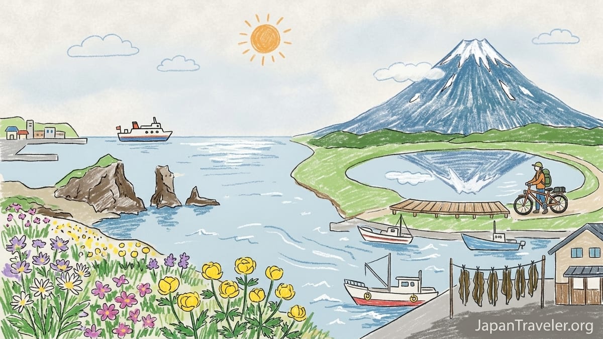
Himenuma Pond is one of Rishiri’s most accessible and photogenic viewpoints, and it justified its reputation the afternoon I arrived. A short, nearly flat loop trail of about one kilometer circling the pond allowed for multiple angles on Mount Rishiri’s reflection. When I first reached the wooden boardwalk, the summit was hidden in fast moving cloud and only the lower flanks showed through, lush with summer green. Over the next half hour, the atmosphere changed repeatedly. Patches of blue appeared, a hint of the crater rim sharpened in the pond’s surface, then vanished again as another bank of cloud slid in.
Summer temperatures here, even in mid-afternoon, hovered near 19 degrees, but the wind gusts were cool enough that many visitors wore light jackets or fleeces. The speedy shifts in visibility are typical around isolated volcanic peaks where moist marine air rises and condenses. Locals at a small café near the parking lot joked that if you do not like the view, you simply wait five minutes. From a safety perspective, though, this volatility has more serious implications higher up the mountain. Even hikers with strong fitness who underestimate wind and cloud at elevation can find themselves in whiteout conditions or chilled far more than expected.
I had originally considered a summit attempt on Mount Rishiri, but conditions during my stay made that unrealistic. Weather reports showed gusty winds and cloud wrapping the upper slopes for most of the weekend. Trail descriptions note that the climb involves rocky terrain, sections of chains, and about 1,500 meters of ascent from trailheads such as Oshidomari or Kutsugata, meaning a long and strenuous day even for experienced mountaineers. Without a clear weather window, full alpine gear and prior practice on similar Japanese volcanoes, I decided that Himenuma and lower coastal viewpoints were the right level for this particular trip.
Instead of chasing the summit, I used the bike to reach other viewpoints on the northern and western coasts. Short detours led to small sea cliffs and capes where the mountain loomed directly above the shoreline. One late afternoon I pedaled out to a modest lookout west of my inn. There, with no guardrails and only a few interpretive boards, I watched cloud race around Rishiri’s upper bowl while fishing boats moved below. It was a colder, rougher scene than anything in Japan’s southern islands, more reminiscent of subarctic coasts than subtropical resorts.
Local Food on Rishiri: Kombu, Sea Urchin and Island Seafood
Meals on Rishiri reflect the island’s maritime economy. Rishiri kombu, a thick kelp that grows in the clear offshore waters, appears in everything from breakfast miso soup to high-end dashi used in restaurants across Japan. At my inn, the owner proudly showed me a line of kombu drying outside under muted sun, long dark strips flapping in the wind. That evening’s dinner began with a simple broth made from this kombu alone, its flavor deeper and more layered than the instant stocks many travelers may know, followed by sashimi and grilled fish.
Sea urchin, or uni, is another specialty here, particularly in early summer when fresh roe is in season and some local eateries serve rice bowls piled with raw uni and ikura. On my visit, the owner explained that recent seas had been rough and supply was tight, so while a small portion of uni appeared as part of a mixed seafood plate, the lavish uni-don sometimes photographed in tourist brochures was not on offer. This was a useful reminder that in real communities, seasonal seafood availability responds to weather, catch volumes and conservation rules, not visitor expectations. I appreciated the smaller taste all the more for knowing it reflected that week’s reality.
Breakfasts were hearty, which suited days of biking and walking. My favorite morning spread on Rishiri included grilled salmon, a block of tamagoyaki, rice sprinkled with shredded kombu, and a small dish of pickles, accompanied by hot tea. Around the island, casual meals can be found at small diners near ports and on main roads, often focusing on ramen topped with local seaweed or simple fried fish sets. Prices for such meals in 2026 run in the range of 900 to 1,500 yen for a filling bowl or plate, slightly higher inside some guesthouses where dinner and breakfast are part of a set half-board rate.
Compared with the subtropical south, the culinary mood here was darker, saltier and more restrained. There were no shaved ice stands or beach bars, but plenty of quiet counters where islanders ate bowls of noodles under television news. For a traveler interested in regional food, the experience feels less like being catered to with vacation clichés and more like being folded for a few days into the everyday routines of fishing communities shaped by long winters and short, intense summers.
Getting Around Without a Car: Buses, Bicycles and Ferry Constraints
Over my nights on both islands I deliberately skipped renting a car to understand how feasible a flower and hiking focused trip would be by public transport and bicycle alone. The answer is that it is absolutely possible, but only if you embrace early starts, planning around sparse bus timetables, and occasional long walks on paved roads. On Rebun, the main bus routes connect Kafuka with trailheads near Momoiwa, Cape Sukoton and other northern viewpoints, but service outside peak hours can be limited to every few hours. I often found myself building an entire day’s plan around two key departure times: one to get out in the morning and one to return in the afternoon.
A sightseeing bus option exists on Rebun, running fixed circuits to well known viewpoints such as Cape Sukoton and Cape Gorota. This service is convenient for those who prioritize light walking and photography over longer hikes, and it bundles commentary in Japanese with the transport. For hikers wanting to commit three or more hours on a single trail like the Momoiwa Observatory Course, the sightseeing bus feels too rigid. It is easier to pair local route buses for access and e-bikes or walking for flexibility at the destination. However, those with large suitcases might prefer the sightseeing buses simply to avoid wrestling luggage on regular routes.
On Rishiri, cycling proved more efficient than waiting for buses, especially for exploring the lowland ring around the mountain. The trade off is exposure to weather. Headwinds can turn a planned 40 kilometer day into something that feels closer to 60 in effort, and cold drizzle can sap motivation quickly. Local e-bike rental services mitigate some of this, but it still pays to pack gloves, a waterproof jacket and a warm layer in your pannier. For travelers not comfortable on a bike, rental cars are widely available near Oshidomari and Kutsugata, though summer availability can tighten and advance reservations are wise.
The biggest constraint across both islands is the ferry timetable back to Wakkanai. My original plan had been to leave Rishiri on a late afternoon sailing, giving me a nearly full day of biking. A forecast of increasing winds, coupled with staff warnings that later ferries might be cancelled or combined, led me to move to an earlier departure. That decision truncated my final ride but spared me an unplanned extra night. Fellow travelers who tried to visit both Rebun and Rishiri as rushed day trips from Wakkanai often found themselves anxiously watching weather updates and clock, sometimes cutting hikes short to ensure they did not miss the single feasible return sailing.
The Takeaway: Choosing Between Rebun and Rishiri
By the time I sailed back to Wakkanai, boots scuffed and camera card full, the differences between Rebun and Rishiri had sorted themselves into clear impressions. For pure hiking joy, I preferred Rebun. Its coastal trails, especially the Momoiwa Observatory Course and routes near the Rebun Usuyukiso area, offered a blend of flowers, airy ridges and ever changing sea views that felt unlike anywhere else in Japan. Elevation gains were modest, trailheads were accessible without a car if you planned carefully, and the cool summer temperatures made long days outside comfortable despite wind and mist.
Rishiri, by contrast, felt like a mountain watching over everything. Even without summiting, cycling around its base and circling Himenuma Pond gave a strong sense of scale. I enjoyed my overnight stay here, especially the food centered on Rishiri kombu and local seafood, and I would return for photography focused on the volcano in different conditions. However, in the time I had, Rishiri felt less like a hiking playground and more like an alpine goal that I had only circled, waiting for a future trip with better weather, more specialized gear and a partner equally prepared for a demanding summit day.
The most inconvenient transport arrangement of my trip was relying solely on sparse local buses on Rebun while also trying to photograph golden light around sunrise and sunset. With only a couple of departures early and late in the day, my options were either to walk long stretches of road in half light or pay for occasional taxis. On a future visit, I might still skip a car, but I would seriously consider arranging a rental bicycle on Rebun as I did on Rishiri, or staying within walking distance of one main trailhead to minimize daily shuttling.
If I return, it will likely be in late June or early July again, carrying the same mix of rain gear and warm layers, and I would come with three aims. First, to spend more time on Rebun’s longer north south trekking courses to experience the full “floating island of flowers” effect over a full day. Second, to plan a photography focused stay on Rishiri with flexible days reserved purely for watching how the mountain reveals and hides itself in shifting cloud. Third, perhaps on a later trip and with proper mountaineering preparation, to attempt Mount Rishiri’s summit on a stable weather window. For travelers weighing Japan’s northern edge against its famous southern beaches, my own experience suggests that if you crave wildflowers, coastal ridges and volcanic silhouettes instead of tropical heat, these northern islands reward every extra night you give them.
FAQ
Q1. How many nights should I spend on Rebun and Rishiri Islands?
For a hiking focused trip, plan at least two nights on Rebun and one on Rishiri. This allows one full hiking day on each island with a buffer for ferry delays and weather changes.
Q2. When is the best time to see wildflowers on Rebun?
Wildflowers on Rebun typically bloom from late June through July. Exact species and peak density vary each year with spring temperatures and rainfall, so any visit in that window can be rewarding.
Q3. Do I need mountaineering experience to visit Rishiri?
You do not need mountaineering experience to enjoy lower areas like Himenuma Pond or coastal viewpoints. However, attempting the summit of Mount Rishiri requires strong fitness, proper gear and stable mountain weather.
Q4. Is it realistic to visit both islands as a day trip from Wakkanai?
Trying to see both islands as day trips is not recommended. Ferry schedules and weather related cancellations make such plans stressful and rushed, leaving little time for meaningful hiking.
Q5. How cool is the summer weather on Rebun and Rishiri?
Summer daytime temperatures often hover around 15 to 20 degrees Celsius, with frequent wind, sea fog and light rain. Pack layers, including a light insulated jacket and waterproof shell.
Q6. What is the Momoiwa Observatory Course like for average hikers?
The Momoiwa Observatory Course on Rebun is roughly 6 to 7 kilometers with around 250 to 300 meters of ascent. It suits hikers comfortable with uneven ground, narrow ridges and changeable coastal weather.
Q7. Can I get around the islands without renting a car?
Yes, you can use local buses, sightseeing buses and rental bicycles, especially e-bikes. Schedules are limited, so you must plan around departure times and accept some walking between stops and trailheads.
Q8. What local foods should I try on Rishiri and Rebun?
Look for dishes featuring Rishiri kombu in soups and stocks, fresh local fish, and sea urchin rice bowls when sea urchin is in season. Guesthouse dinners often highlight these ingredients.
Q9. How often are ferries cancelled due to weather?
Ferry cancellations are not daily but are common enough, especially in windy or stormy periods, that travelers should allow an extra buffer day in their wider itinerary and avoid tightly timed connections.
Q10. Would you return more for wildflowers, photography or a mountain climb?
I would return first for Rebun’s wildflower trails, second for photography of Mount Rishiri in different light and seasons, and only attempt the summit with a future trip dedicated to mountaineering conditions.